Cooling and plant
Environmental health and the case officer read chiller arrays, dry coolers, and generator lines for noise and visual impact. A plant yard still at true scale answers both tests in one frame.
Data centre planning CGI · UK
StratumCGI produces CGI for data centre planning applications on hyperscale and colocation schemes where officers, consultees, and committee members test massing, cooling plant, and energy infrastructure against a fixed decision date. Send drawings and your council date now for a deadline check.
Data centre applications draw scrutiny that a warehouse scheme never sees. The scrutiny lands on MW load, substation compounds, cooling plant, night-time lighting, and green belt openness. Planning-grade stills answer those points from the same model as the submission drawings.
A data centre application faces distinct decision stages, and each stage tests a different drawing. Pre-application officers test massing and siting, consultees test operational impact, and committee members test the contested edges within minutes. The planning CGI pack answers each stage with stills built from one model tied to the application drawings.
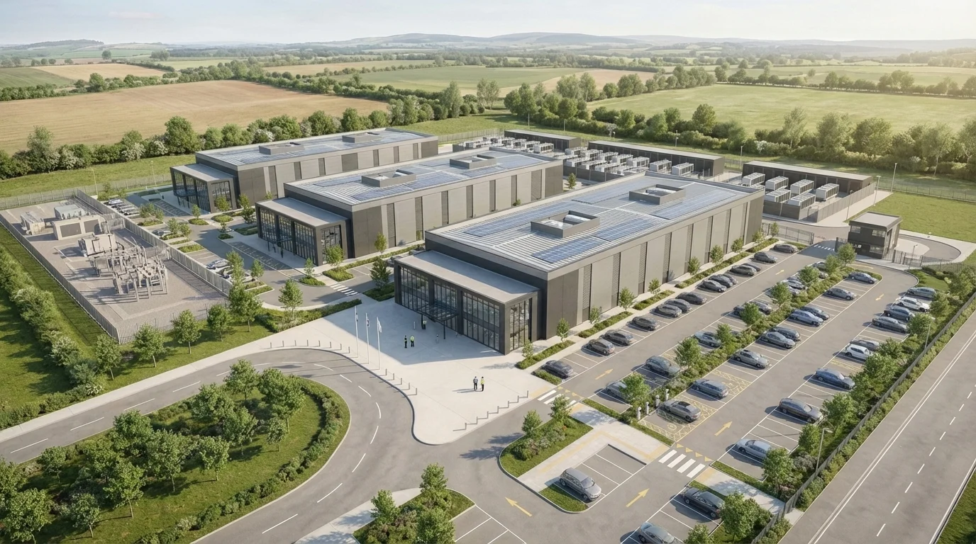
Aerial context still: campus massing, plant yard, and neighbouring land in one officer-readable frame.
Schemes consented in 2025 show the scale an officer now expects to read. Gross external area runs 72,000 to 84,000 sqm, IT load around 90 MW, and data hall heights about 20 m. At that scale, massing is the first test. A still that understates height or footprint fails the same check the drawings will face.
The table maps each planning stage to the deliverable that stage reads, so the pack is commissioned against the decision sequence rather than a generic image count.
| Planning stage | Deliverable | Primary reader |
|---|---|---|
| Pre-application | Massing stills and aerial context views | Planning officer at the advice meeting |
| Outline application | Parameter-plan massing views and site context stills | Case officer and consultees |
| Detailed application | Planning stills, plant and substation views, material-readable elevations in context | Validation and case officer review |
| Public consultation | Consultation boards and neighbour-facing approach stills | Residents, parish councils, and statutory consultees |
| Planning committee | Committee-pack stills of contested edges and access | Members and committee officers |
A pack that skips a stage leaves that stage's reader with the drawings alone, which is where height and plant get misread. Commission the set against the full sequence.
At the detailed stage, camera positions tighten to agreed viewpoints. Where consultants require surveyed accuracy on those cameras, the work routes to verified views / AVR photomontage methodology rather than the standard planning set.
The three frames show the stage sequence on real commissions. Grey massing comes first, the campus masterplan second, and a receptor-level daylight view of the scheme edge last.
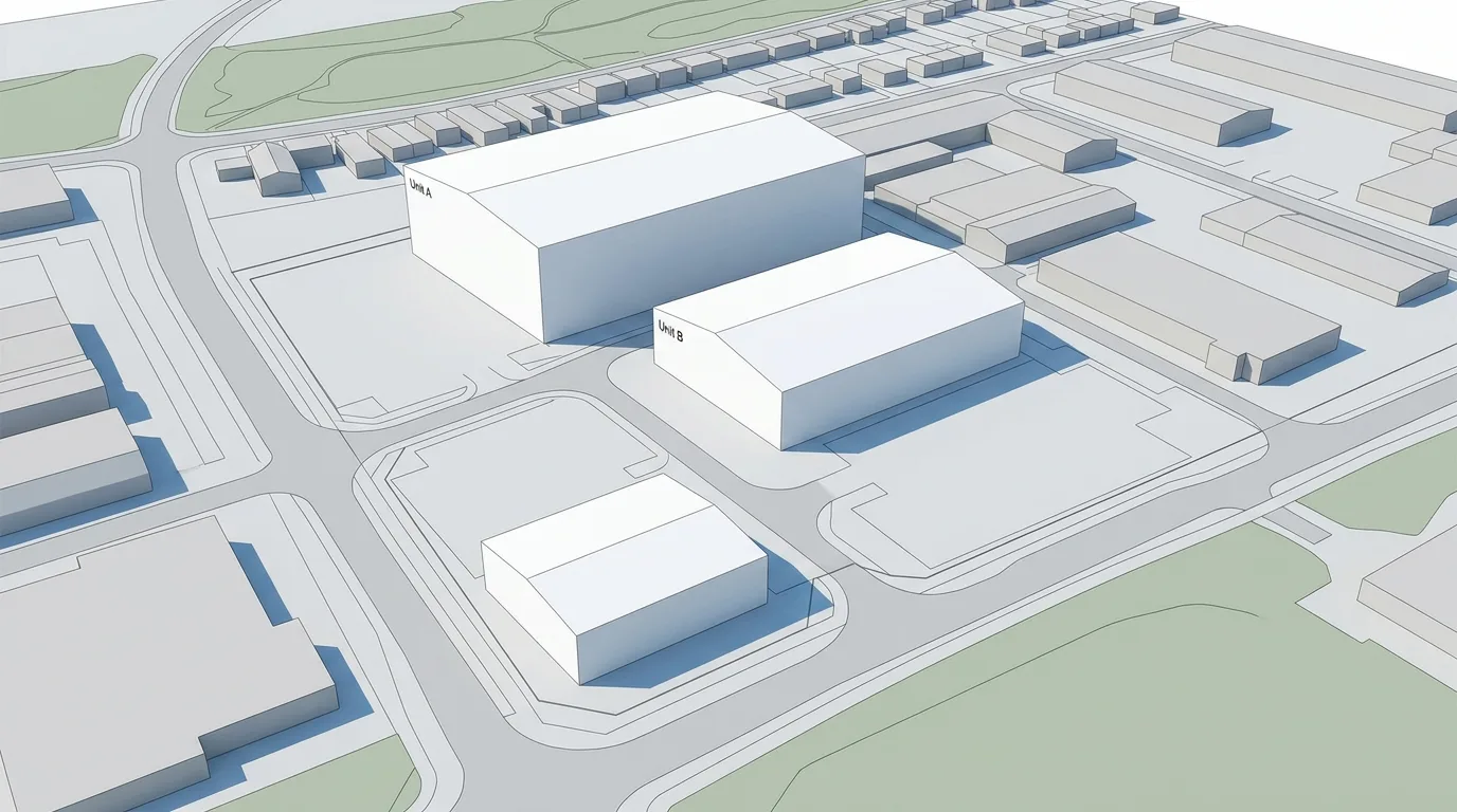
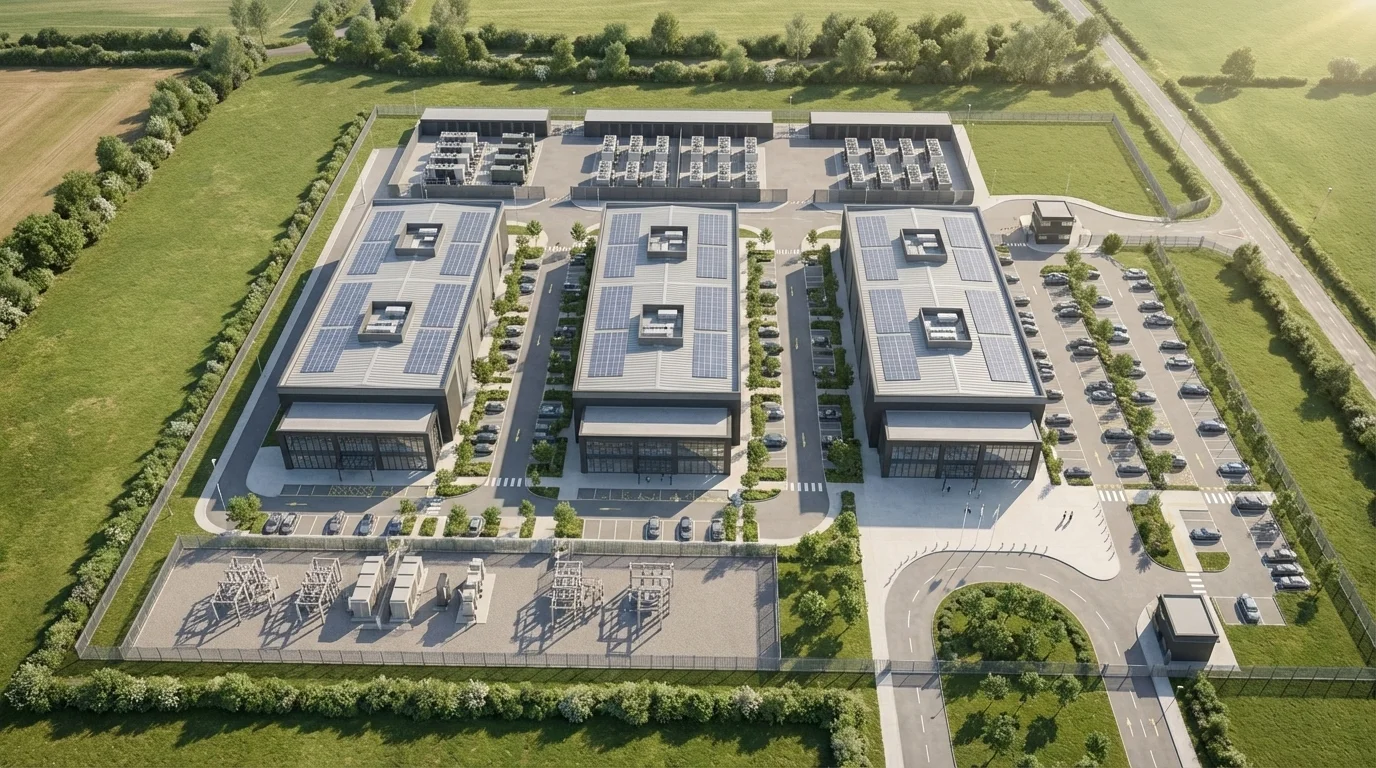
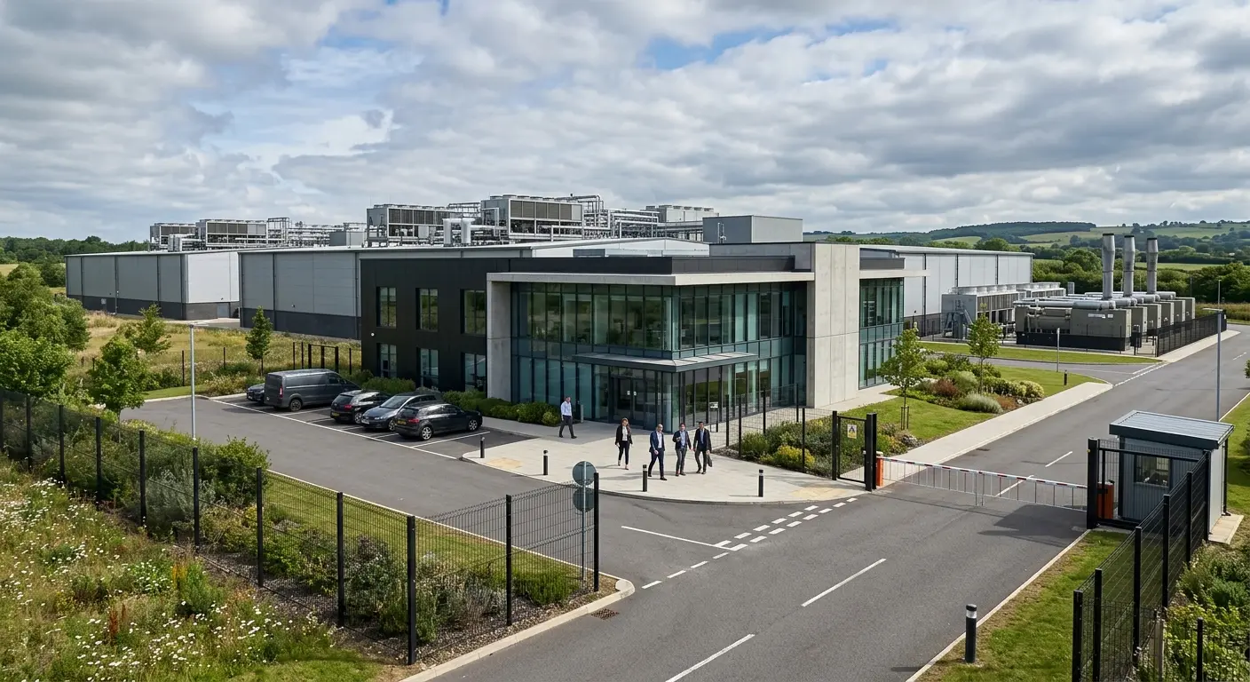
Each gallery frame is built from the model behind the submission drawings, so an officer can check any still against the elevations already on file. Those same stills then face the consultees who test the scheme's operational infrastructure.
Case officers and consultees target the operational infrastructure of a data centre scheme, not the shed itself. Cooling plant, substations, security perimeters, lighting, and landscape screening each attract a named consultee, and each needs a still that presents it honestly.
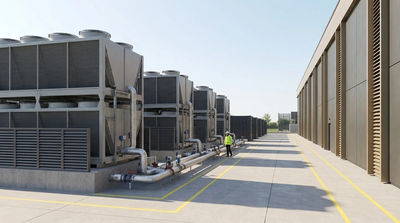
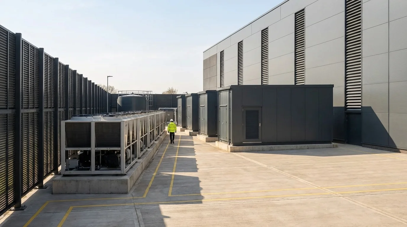
Cooling plant documented as built: external equipment and pipe runs visible, not screened out of frame.
Three drivers decide most data centre applications. The cards set out what each consultee reads and the view that answers it.
Cooling and plant
Environmental health and the case officer read chiller arrays, dry coolers, and generator lines for noise and visual impact. A plant yard still at true scale answers both tests in one frame.
Energy infrastructure
HV substations and grid connections carry the MW argument. A substation compound view shows transformer massing, fencing, and separation distances that a layout drawing flattens.
Security and access
Perimeter fencing, gatehouses, and vehicle search areas define the scheme's public face. A security entrance still captures that edge from the approach a neighbour uses.
Night-time lighting
Night-time lighting is the fourth driver, and one honest night still says more than a sequence. Officers and residents read spill light, security luminaires, and yard lighting against dark rural skies, and a dusk frame records those sources as specified rather than dimmed for effect.
Leave any of these drivers undocumented and the objection lands on the drawing set instead, where it is harder to answer.
The gallery gathers the scrutiny points into one proof set, covering the substation, the security entrance, night lighting, the plant yard, and the wider townscape relationship.
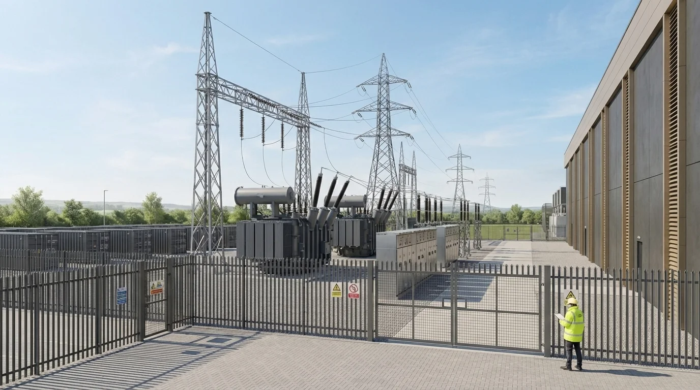
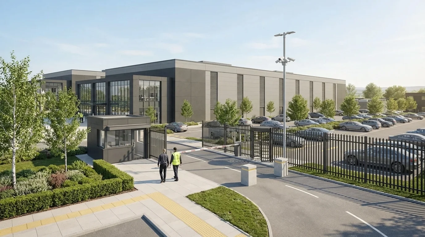
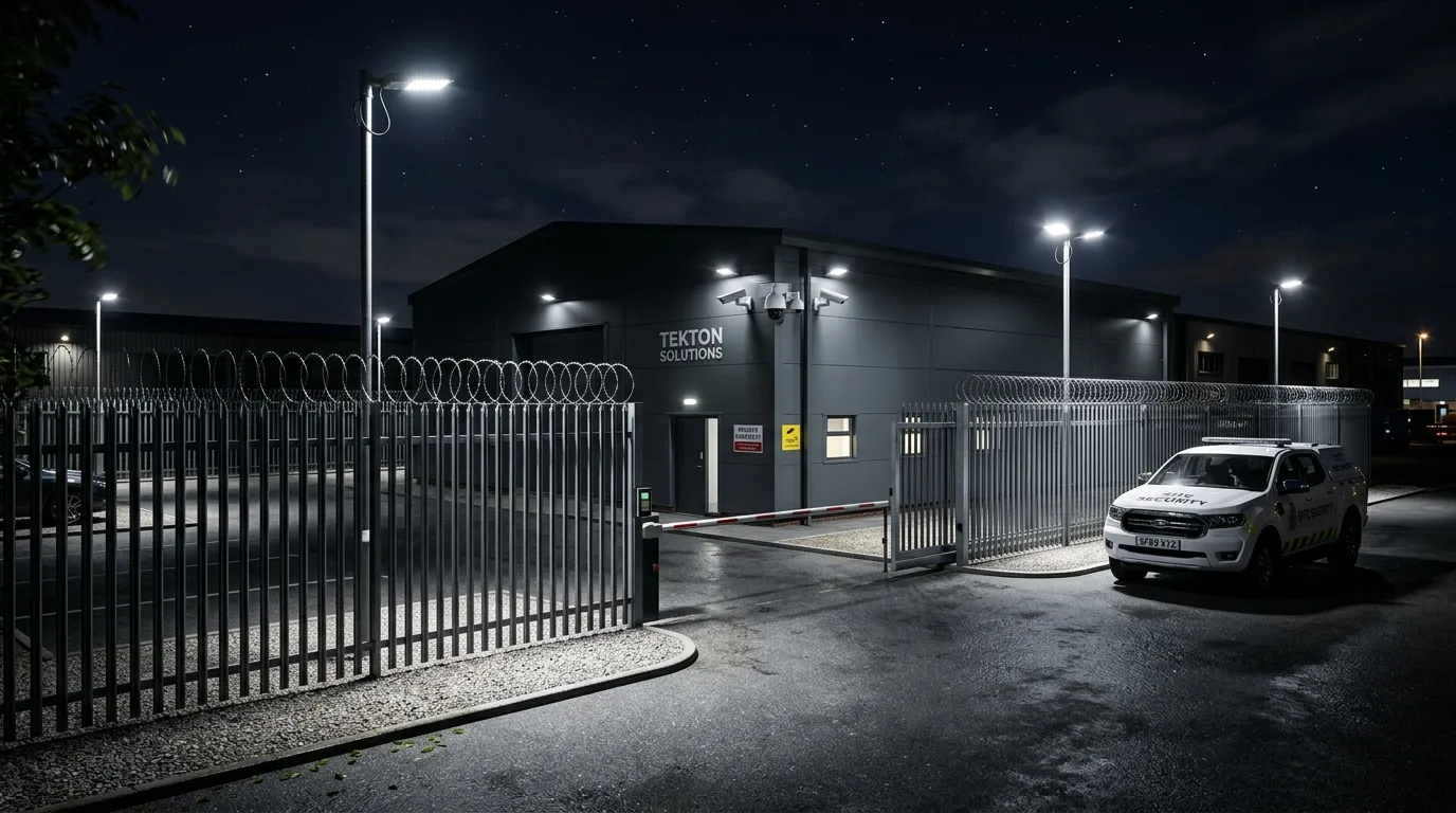
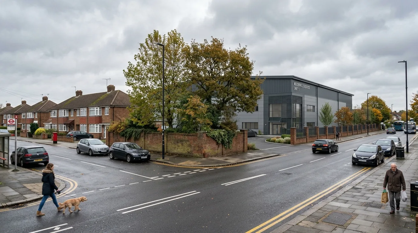
Every frame in the gallery is drawn from the application model, so the scrutiny answer and the submission drawing never diverge.
Landscape officers test screening at two horizons, the day-one view and the designed maturity view. Planting shown only at year 15 overstates the near-term mitigation; planting shown only at year 1 understates the landscape strategy. The pack captures both horizons from the landscape drawings so the officer can weigh the interim condition honestly. Wider scheme context sits on the data centre visualisation service page. On green belt and grey belt land, the same honesty test widens into the openness question that decides these schemes.
Data centres on green belt and grey belt land are decided on openness, and openness is a visual test before it is a policy test. The stills an inspector sees have to show the scheme's true spatial and visual effect on the gap, not a softened version of it.
This before-and-after pair is a generic planning study from the StratumCGI showcase library. It illustrates how the format records change in openness; it does not depict a data centre or any named greenfield site.
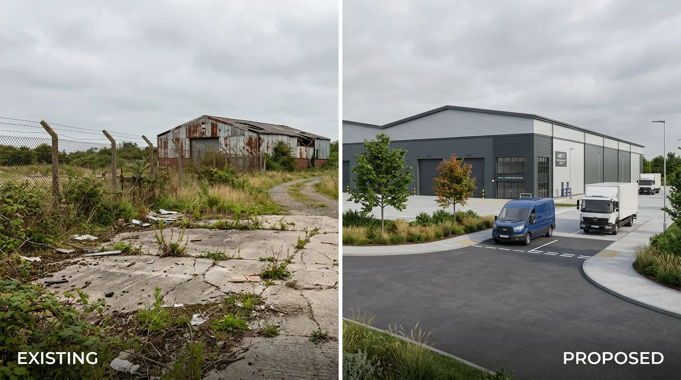
Before-and-after study format: existing openness on one side, proposed massing on the other, for an openness assessment.
Used honestly, the before-and-after format lets an inspector weigh the spatial change directly; used loosely, it becomes the first document an appellant challenges.
The government published its DC01UK data centre planning study on 23 January 2025. The Woodlands Park data centre appeal, reference 3347353, was granted on 9 July 2025. The Abbots Langley data centre application was recovered for Secretary of State decision in May 2025. The Wilton International data centre scheme appears on the Planning Inspectorate casework portal under plan 648645. These are public-record citations of live casework, not StratumCGI commissions.
Recovered and appealed schemes raise the evidential bar, because every visual in the file may be re-read at inquiry. Appeal-grade planning CGI keeps cameras, heights, and landscape maturity tied to the survey and the drawings so the set survives that second reading. The two anonymised data centre commissions below show the standard applied at campus scale.
North West Hyperscale Data Centre (SCGI-002)
Cloud-campus scale commission: data hall massing, plant yard, and security perimeter produced to planning-grade accuracy under StratumCGI's anonymised portfolio policy.
View the North West Hyperscale Data Centre case study (SCGI-002)
Hyperscale AI Data Centre Campus (SCGI-003)
AI GPU campus commission: four-hall masterplan, liquid cooling plant, HV substation, and BESS compound documented from a single planning model.
View the Hyperscale AI Data Centre Campus case study (SCGI-003)
Portfolio proof matters on openness schemes because the visual method, not the marketing polish, is what an inspector tests.
Since 8 January 2026, data centre schemes in England can be directed into the nationally significant infrastructure project regime under section 35 of the Planning Act 2008, alongside the conventional local planning authority route. The change sits within the consenting reforms carried through the Planning and Infrastructure Act context as at July 2026. Route choice affects who decides the application and which document set the planning stills must serve.
The two routes bring different readers to the same scheme, as the table sets out.
| Route | Decision body | Visual evidence context |
|---|---|---|
| LPA planning application | Local planning authority, with committee decision on major schemes | Officer report, consultation boards, committee pack |
| Section 35 NSIP opt-in (DCO) | Examining authority and Secretary of State | Environmental statement figures and examination documents |
Whichever consenting route the scheme takes, the visual set is read as evidence, so every still stays tied to the model behind the submission drawings.
Data centre planning pack
What the studio delivers
One coordinated set of planning-grade stills from a single model: massing and aerial context views, plant yard and substation frames, security entrance and night-time lighting stills, landscape screening at year 1 and year 15, and committee-pack short-read frames.
Scope and pricing path
Quoted per scheme
Data centre packs are quoted per scheme because each scheme's MW scale, viewpoint count, and landscape maturity change the modelling hours and camera set the pack needs. Where a broader industrial benchmark helps, the published industrial CGI pricing page sets the frame before a fixed quote is confirmed.
Deadline discipline
Fixed against your date
The pack timetable tracks the decision date you name, whether that is the pre-app meeting, the consultation print, the committee agenda, or the examination deadline. Delivery is confirmed against that date before production starts.
Include drawings, the MW scale, and the decision date the pack must hit.
A data centre planning pack is commissioned against four input groups. Supply them complete and the quote is fixed; supply them late and the decision date absorbs the rework. The wider commissioning frame sits on the CGI for planning applications hub, and production follows the five-stage industrial CGI process.
The checklist is the minimum set a data centre pack is built from.
With those four inputs on file, every still in the pack traces back to a document the officer already holds, which is the accuracy standard the decision date depends on.
CGI for data centre planning applications is computer-generated imagery produced as evidence for the planning determination of a data centre scheme. It is a specialist branch of planning application CGI, which is itself a branch of industrial architectural visualisation, distinguished by the decision stage it serves rather than the polish of the image.
Two boundaries keep the category honest. Against marketing CGI, planning-grade stills keep massing, plant, and lighting tied to the drawings, where marketing imagery is free to soften them for a sales audience. Against AI-generated imagery, uncontrolled generated images invent geometry and context that cannot be reconciled with the application file, so they do not substitute for planning-grade stills on a live submission.
Pre-application, outline, detailed submission, public consultation, and planning committee each read a different deliverable, from massing stills at pre-app to committee-pack frames at decision. The stage table maps the sequence.
Cooling plant, substations and grid infrastructure, security perimeters, night-time lighting, and landscape screening maturity. Each driver needs a still that shows it at true scale from the application model.
The route changes the reader, not the accuracy standard. In force for England since 8 January 2026, the opt-in moves determination to an examining authority and the Secretary of State, where visuals serve environmental statement figures and examination documents.
Uncontrolled AI-generated imagery invents geometry, materials, and context that an officer cannot reconcile with the drawings. StratumCGI does not substitute that class of image for planning-grade stills on live submissions.
CGI for data centre planning applications
Massing, cooling plant, substation, lighting, and screening stills prepared from your GA drawings, material schedule, and viewpoint schedule, fixed against your decision date.
Request a Quote